
On May 1, 2018, the volcano area began to get a cluster of earthquakes - 220 in 24 hours. This MAY signal oncoming activity in the volcano. To give you a perspective on what this means for our visit, I've created the map below.
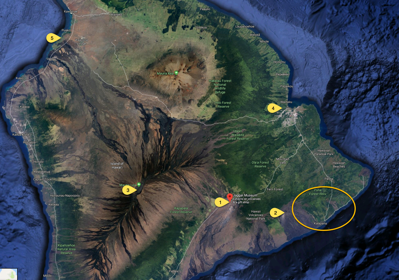
Key
- Jagger Museum - This is also very close to Volcano House hotel. We often talk about it being on the summit but it is really below the summit of Mauna Loa (#3) on the windward side.
- This is the area of the Puʻu ʻŌʻō Vent. This is where the activity of the past few years has been centered. It is from this vent that lava has flowed to the ocean. The town of Kalapana is below and to the east of this vent - although there are no structures remaining. The lava flows destroyed all homes in the area a few years ago.
- Mauna Loa summit. Mauna Loa was one of the most active volcanoes in recent history. Today Kīlauea has taken that honor.
- Hilo. The town of Hilo is on the east side of Hawai'i. To get to Volcano National Park you would go through Hilo. This side of the island is significantly wetter than the Waikoloa coast (#5).
- Waikoloa - This is where our hotel is located. It is the dry side of the island and out in the middle of lava flows from the mid-1800's.
- The Yellow Circle is the area that scientists anticipate any activity under the current conditions. They have detected lava flowing under Hwy 130 - the road on the map running diagonally through the yellow circle.